Step 01
Draw your land
Trace the boundary on the map, exclude the unusable areas and add the trees already there.
Plan olive groves, orchards and new woodlands directly on the map. Draw your land and find out how many trees you can fit, how to lay them out and the yield you can expect.
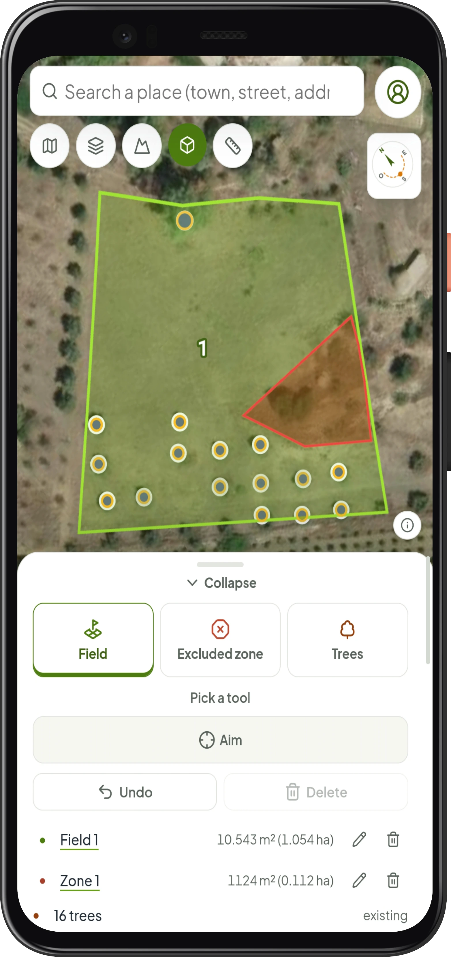

Define the area, choose what to plant and let Forest Maker build the plan.
Trace the boundary on the map, exclude the unusable areas and add the trees already there.
Choose the crop, the planting spacing and the row orientation.
Review the results and export your work for the field, your technician or GPS.
Trees, rows, yield, costs and irrigation are calculated on the real shape of your land.
Choose olive, citrus, almond, hazelnut, walnut and woodland, with parameters suited to each crop.
Assess slope, aspect and contour lines before orienting the rows.
Get numbered rows, lengths and linear metres; size drip lines, emitters and flow on the real rows.
Estimate planting cost, revenue, break-even and investment payback time.
Compare satellite, street and topographic maps and review historical imagery to plan your land with confidence.

A clear reference to assess, share and take to the field.
Assess tree count, costs and expected yield before starting work.
Prepare a first georeferenced draft to verify during the site visit.
Share rows, quantities and coordinates with the nursery, crew and technician.
Draw your first plot and see straight away how it can become a real plan.